• HOME
  • ​Ho’okuleana Design
  • Ala Wai Watershed Resource Study Report
  • Conservation
  • Personal Growth
  • Diseño de Entorno Construido
  • Consultoría de Construcción
  • Asuntos Culturales
  • Vídeos Varios
  • About Emy Louie - 雷慧妮
  • Contact
  Emy Louie, Consulting Services

"HO’OKULEANA 
​DESIGN" 
​
C2016,2017 

A Proposal for the
​Ala Wai Canal and Waikiki
Honolulu, Hawaii, USA
As the Albizia trees in Mānoa need to be addressed first, then a proposed design for the Ala Wai Canal and Waikiki follows, which is communicated below through the following formats:
  • locational maps
  • pictures and in house and outside videos
  • blogs and frequently asked questions
  • drawings, sketches, and artistic renderings
Picture
Below. A short video which shows
​an overview of the design features. ​
See also a BLOG.
Below. A narrated video of the area
​around the “Heiau.” ​
See related BLOG.
​ Below. A video of an aquaponics display at the "Hyatt Regency Waikiki Beach Resort and Spa." See related BLOG.
Picture
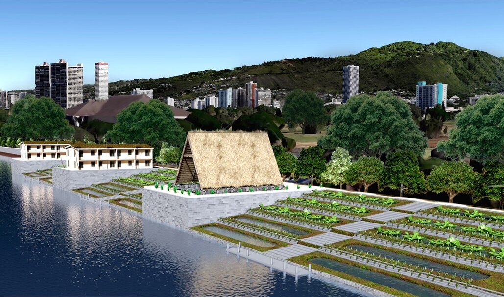
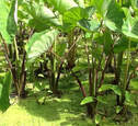
​Besides that it solves environmental problems, “kalo” or taro, is an excellent food source and serves as the centerpiece of the Hawaiian culture. However, compared to the dependence on imported foods that come to Hawaii, the reliance on locally grown food, like taro, has been minimized. Now that regulations from governments around the world due to COVID-19 have disrupted global food supply chains, food sovereignty, or the ability for local communities to grow their food to feed the local population, is critical!

Below. Location
​of visitor center
and park. See the accompanying BLOG.
Below.
Locations of heritage centers, Hale Pilis,
aquaponics which involve fish and taro. See related BLOG.
Below. Location of BMX park
and radio-controlled
model car circuit. See BLOG. Below right. Drone park. See BLOG.
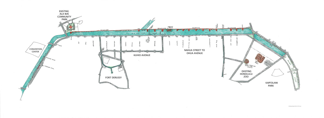
Below. Overall directional map of significant design features which are in Waikiki. 
​Google Maps which are above and below the directional map, mark exact locations.
Picture
Above. Location of farmers market​. See the accompanying BLOG.
Above. ​A location of "River Walk." See accompanying BLOG.
Left. Narrated video of
​farmers market. 
​ Left. ​"River Walk" gives opportunities to return Waikiki to be natural and provide places for wildlife
To pan on above directional map, download file below. (Note: download may take a little while.)
Site Map
File Size: 5406 kb
File Type: jpg
Download File


"Behind the Glamour of Waikiki: Seawalls,​" BLOG

OTHER INTERESTING LINKS:

In Honolulu: the Dreaded Bathroom Situation
What Is It With the People Who End Up on the Streets?

FAQ on the "Design"

View full report
Ho’okuleana Design ©2016, 2017
​
© 2023  Emy Louie. All Rights Reserved​
Powered by Create your own unique website with customizable templates.